


- All products are added to your cart.
C$19.95
(C$19.95 Incl. tax)
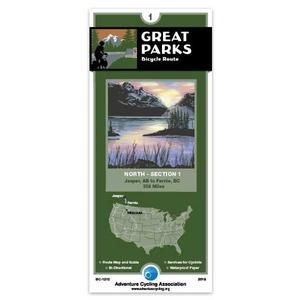
The ACA Great Parks North 1 Map is an essential guide for the northern section of the Great Parks Route. Featuring waterproof paper and detailed cycling-specific data, it navigates riders through the stunning Canadian Rockies and Montana.
ACA Great Parks North 1 Map
Navigate the Crown of the Continent
The Adventure Cycling Association (ACA) Great Parks North 1 Map is a precision-engineered navigation tool designed specifically for self-supported bicycle travelers. This section covers the breathtaking northern reaches of the Great Parks Bicycle Route, guiding cyclists through the rugged beauty of the Canadian Rockies and into the heart of Montana. Unlike standard road maps, ACA maps are built from decades of field research, focusing on the specific needs of cyclists, such as shoulder widths, traffic volumes, and the location of bike-friendly services.
This map provides a comprehensive look at the route from Jasper, Alberta, down to Missoula, Montana. It features a highly detailed elevation profile, allowing riders to anticipate the demanding climbs and rewarding descents of the Rockies. Printed on water-resistant, tear-proof paper, it is built to survive the variable weather of the high country. Beyond simple directions, the map includes vital "Cyclists Only" data, including the locations of campgrounds, bike shops, grocery stores, and water sources, making it an indispensable companion for both solo adventurers and group tours.
Key Features:
- Cycling-Specific Routing: Detailed turn-by-turn directions on roads selected for their scenic value and suitability for bicycle travel.
- Detailed Elevation Profiles: Visualizes every pass and valley, helping riders manage their energy and plan their daily mileage.
- Waterproof & Tear-Resistant: Printed on durable synthetic paper that withstands rain, wind, and frequent folding in a handlebar bag.
- Service Directories: Identifies essential stops including bike shops, campgrounds, motels, libraries (for Wi-Fi), and grocery stores.
- Points of Interest: Highlights natural landmarks, historical sites, and local attractions throughout the Canadian and U.S. Rockies.
- Regional Climate Data: Provides average temperature and precipitation charts to help with seasonal trip planning and gear selection.
- Compact Folding Design: Engineered to fit perfectly into map cases and handlebar bags for easy reference while in the saddle.