


- All products are added to your cart.

C$16.00
(C$16.00 Incl. tax)
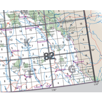
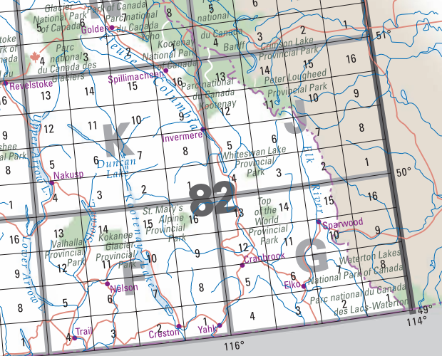
Refer to the index photo for information about the area each map covers. You may need 2 or 3 maps to cover the area you are travelling.
NRCan Topo Map 1:50,000
Topographic maps are suitable for a wide variety of applications, from emergency management, urban planning, surveying, resource development, to camping, canoeing, hunting and fishing to name a few. Why? Because they represent the earth's features accurately and to scale, on a two-dimensional surface.
Topographic maps produced by NRCan conform to the National Topographic System (NTS) of Canada. They are available in two standard scales: 1:50 000 and 1:250 000. Each map in this system has a unique number, which is a combination of numbers and letters. The area covered by a given mapsheet is determined by its location in Canada.